Source: NZ Stuff news article (Feb. 14th 2021) – Natural disasters have hit homeowners in parts of New Zealand hard over recent years, but there are ways to find out if your property is in a high-risk area for natural disasters – and to start planning.
Devastating earthquakes in Christchurch and Kaikoura, major floods around the country including in Southland and Napier last year, the 2019 Nelson bushfires which were New Zealand’s largest in 70 years… these are just natural disasters of the last 10 years.
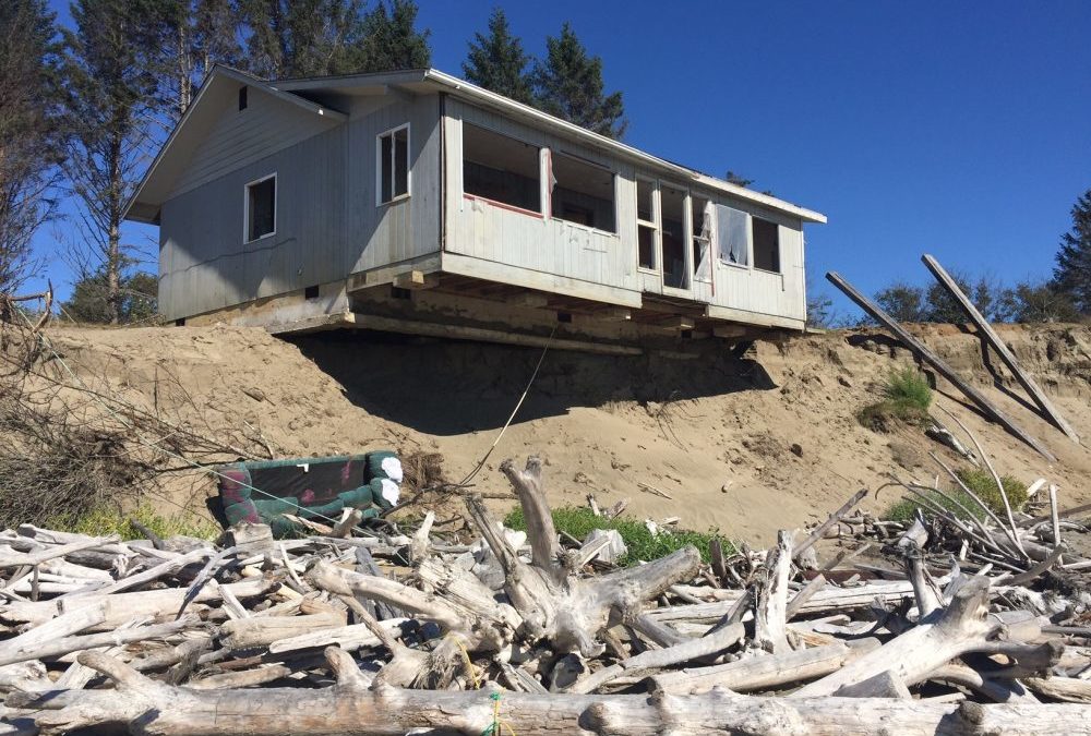
But, thanks to the compounding effects of climate change, the incidence of such disasters and other problematic events, like coastal erosion, is expected to increase over the coming years.
For homeowners, or buyers, that’s a big issue. If you have, or are keen on, a house in an area considered high-risk for a particular type of natural disaster it will, eventually, hit you in the pocket.
The Insurance Perspective
New Zealand insurers, notably the Tower Insurance and IAG group of companies which include the State, NZI, AMI and Lumley brands, have already moved into risk-based pricing for property insurance in areas considered prone to natural disasters.
This has resulted in some substantial premium increases for customers considered at increased risk of natural disaster loss due to the location or type of their property.
This situation is forecast to get much worse. In December, the Deep South National Science Challenge report revealed New Zealand’s rise in sea level is expected to be at least 10 cm over the next 20 years.
That increase of sea level is expected to leave at least 10,000 homes throughout NZ effectively uninsurable by 2050. However, more expensive premiums and policy exclusions could start to be seen within the next 10 years.
This means that as time goes on and the risks amplify, it is critical for homeowners to be aware of the natural disaster risks that might be prevalent in areas they are interested in – and what that could mean for them in the future.
Insurance Council of NZ chief executive Tim Grafton says he would be surprised if most New Zealanders living in high-risk earthquake zones, like Wellington, were unaware of the risks.
But many people seem less cognisant of other risk areas. The ongoing Kiwi love affair with coastal property, despite rising sea levels, is evidence of that.
“I would hope that the appeal of such properties would diminish, but people continue to invest in properties which are near the beach. Traditionally, they have attracted higher values. Yet the closer you are to the beach, the more you will be affected by sea level rise so the greater the risk.”
It’s not just coastal properties that are at risk from the effects of climate change. Flooding is already New Zealand’s most frequent, and costliest, natural hazard.
But rising sea levels affect the water table in areas that are close to high tide, Grafton says. That means that in low-lying areas, even if not on the beach, there is nowhere for the stormwater to go and they will end up flooding more.
“This is a global phenomenon and it impacts on insurance cover which is there for sudden and unexpected events. Currently, insurance covers events like flooding, but if floods continue to hit the area on a frequent basis, it’s no longer a risk it’s a certainty.”
It’s at that point insurance will be affected. Eventually, banks will start to raise questions over the viability of 30-year mortgages on properties in areas affected by rising sea levels, particularly coastal properties, he says.
“This might reduce the chance of getting a mortgage and, in turn, this will affect demand for those properties and the prices of those properties. Resale value will be impacted by this and people who own such properties need to think about how they are placed for the long-term.”
What can homeowners or buyers do ?
How can homeowners, or home buyers, go about finding out if a property is in a high risk natural disaster area?
There’s a range of ways to find out. First up, they should read the Land Information Memorandum (LIM) report for the property. A LIM report has to outline the known hazards, like floods, that the property might face. Checking Google Maps to establish your property’s proximity to potential hazards like waterways is useful.
If a property is up for sale, the vendor and their real estate agent have an obligation to disclose what they know about the property, which should include any known risks. Most council’s should have relevant information on hazards and risks available for property owners to look up and see what their property might face- however this data might be historic. The Commissioner for the Environment reports on, and has maps of, low-lying areas and rising sea levels. Organisations like NIWA and EQC can also provide information to help.
Another good option is to contact Geohazard Assessment Services to arrange an expert and affordable site-specific assessment to identify any potential issues – afterall when thinking about buying a property – its infinitely better (for peace-of-mind) to ‘know the ground beneath your feet’
Recent Comments