COASTAL HAZARDS
We Assess and Interpret – Enabling You to Make the Best Possible, Informed Choice
‘know the ground beneath your feet’
Coastal hazards are on the rise
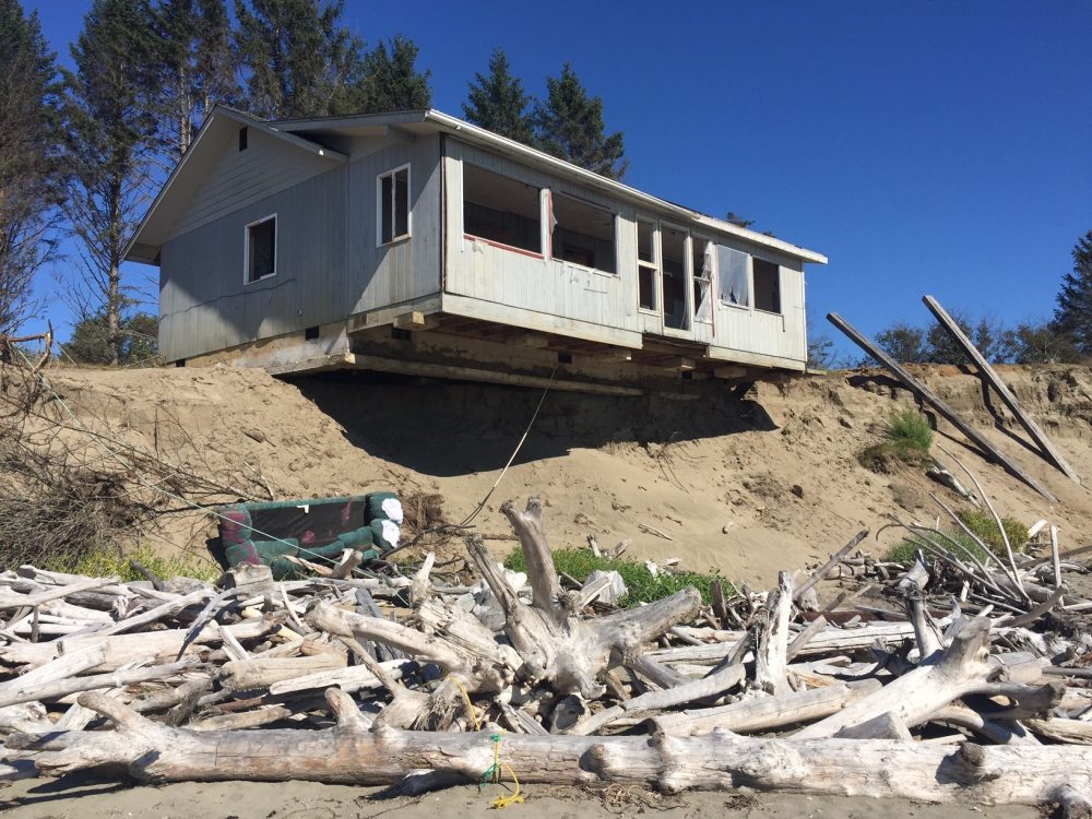
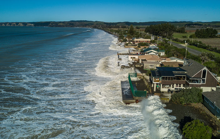
Large tracts of our coastline are fronted by soft sandy sediments or sea-cliffs made of layered sedimentary rock that can erode easily. Storm-generated waves collapse these coastal bluffs and cause the coastline to retreat, threatening vulnerable properties and infrastructure perched near the edge of the sea. Run-off from land areas (particularly in urban areas) and over-saturation of the ground surface from sustained rainfall can further compound the problem.
There is growing national and international consensus that the current rates of coastal erosion could double by the end of this century due to sea-level rise and increased frequency of adverse weather events.
Informed decision making
No-one wants to see their primary investment be steadily eroded away by the surf or crumble into the sea while you helplessly stand by and watch it all unfold. Our geohazard assessments are designed to provide you with advance insights into any potential and unforeseen coastal hazards that may affect your property and well-being. Our aim is to steer you towards making the best possible, most informed decision.
Get a Geohazard Report Before You Buy
More about the inevitability of rising sea level & climate instability
Unprecedented rates of ice-mass loss (Greenland & Antarctica) coupled with thermal expansion of the oceans in our steadily warming world has led to the growing realisation that coastal hazard threats are increasing with accelerating rates of sea-level rise coupled with more frequent severe weather events from what we’re used to.
In many coastal localities, these changes result in more pronounced along-shore shifts in sediment that can result in accelerated erosion of beach frontages and shoreline cliff-faces, and in the process threaten sea-side properties and infrastructure. In short – create more frequent damaging coastal hazard events.
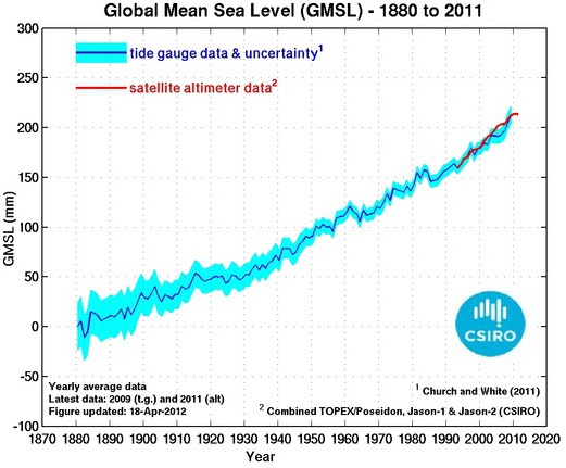
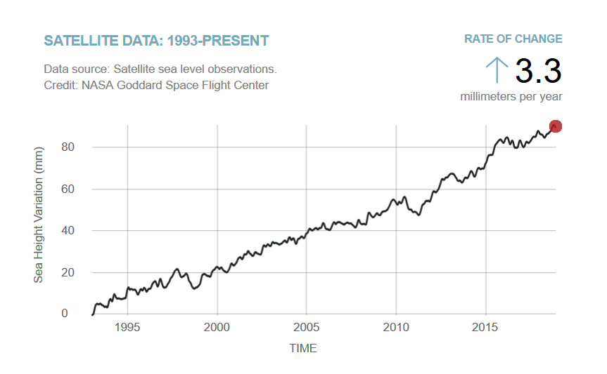
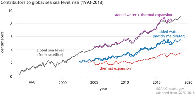
Central and local governmental agencies are now more heavily invested in attempting to better predict, and adapt to, forecasting future environmental changes with proactive planning decisions applied to new coastal fringe developments. However, there still remains considerable uncertainty regarding short- to long-term effects. Currently, New Zealand is experiencing an average relative sea-level rise of 1.76 mm/yr* with rates forecasted to dramatically increase in the coming years.
(*regional rates vary around NZ based on tectonic effects).

Future Sea Level Rise
The current rate of sea-level rise doesn’t sound much but past coastal developments were built on the over-arching premise that sea-level would remain relatively constant and within a more predictable climate regime.
In our steadily warming world this is no longer the case – the rise in sea-level is already adversely affecting properties, human activities and infrastructure along our populated coastal margins, and these sea-level effects are expected to become more severe and common-place with time.
Call Brent On:
021 215 5968
Email Your Enquiry to:
brent@geohazassess.co.nz
What does this all mean to you as an existing coastal property owner or if you’re intending to purchase a property?
Whether its beach frontage or cliff-top, for peace of mind (and increasingly for bank lending and/or insurance purposes) it’s important to identify your potential coastal hazard exposure (i.e. asset damage and loss resulting from wave inundation and flooding, erosion, landslides and rock-falls). This can be achieved by first evaluating the type, spatial extent and magnitude of any hazards present, and then by quantifying, if possible, the likelihood of identified hazards occurring and adversely affecting your property and its value within a given timeframe.
An issue of scale … painting properties with the same geohazard brush? … We don’t think so !
Why site specific assessment is fundamental
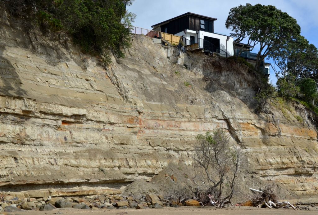
The likelihood of a particular-type of hazard occurring at any given point can be attributed to a wide-ranging assemblage of interrelated factors (i.e. bedrock or sediment type and its architecture, occurrence of faults and other structural defects, thickness and strength of over-burden soil material, aspect, wave energy potential, presence/absence of vegetation) – factors of which can significantly vary from one property site to the next.
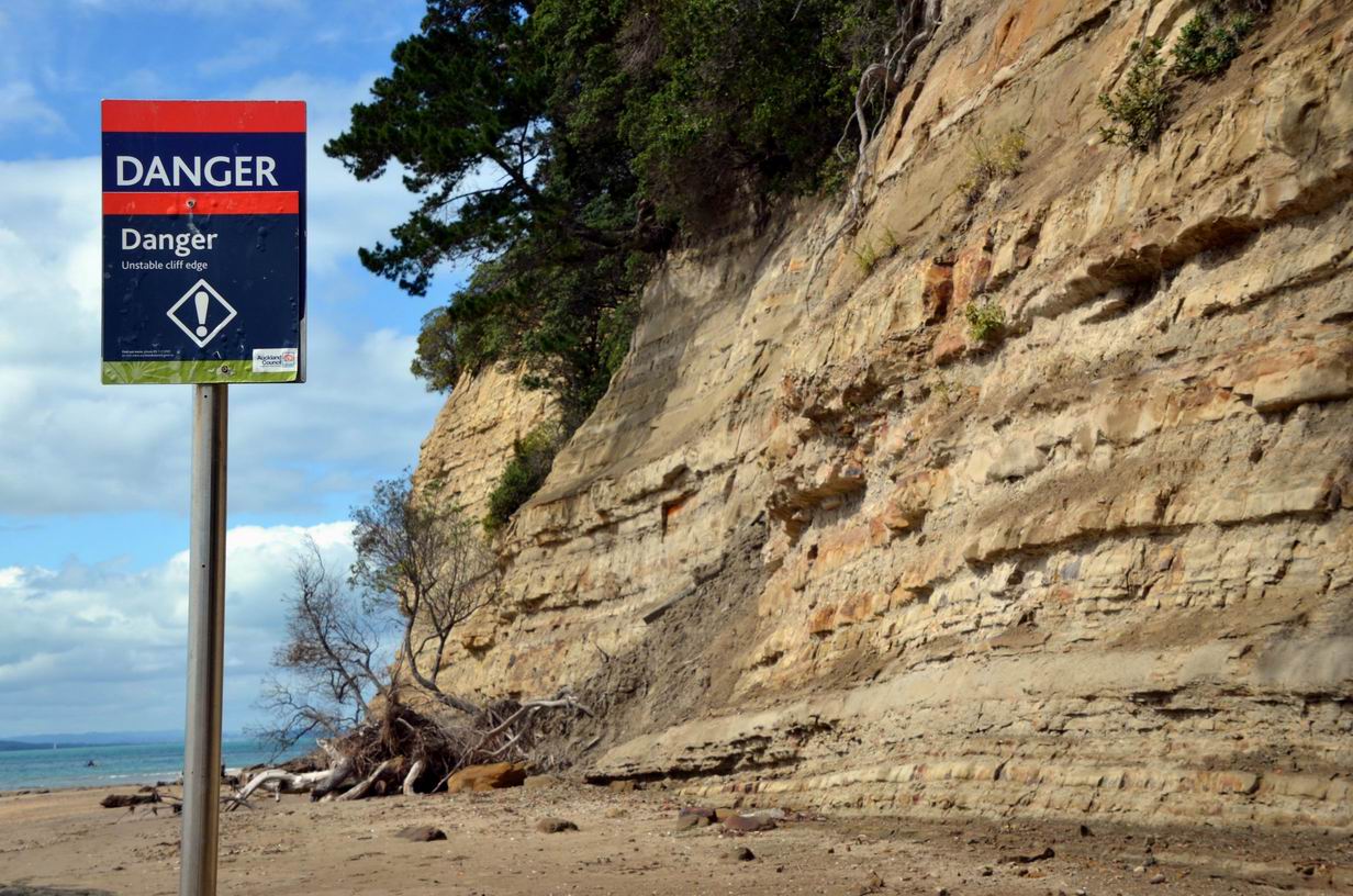
On this basis, it’s therefore necessary to have a knowledgeable and experienced set of eyes on the ground evaluating this variability that could influence the likelihood of a hazardous event occurring in the future.
Factors influencing overall ground stability can dramatically change from one property to the next
What an experienced geoconsultant can do for you …
Based in Auckland, we have region-wide experience but can equally provide quick and affordable assessments in any area of New Zealand with an emphasis on reliably identifying your exposure to any hazard that may potentially compromise your well-being and the value of your property.
We offer other services:
- High-resolution horticultural and/or viticultural soil-landscape mapping
- Identifying, delineating and characterising fault structures and evaluating slope stability
