Auckland City has high exposure to coastal hazards including coastal instability and erosion since the region has over 3,200 km of coastline including three major harbours and a range of sandy beaches and dunes, rocky shores and cliffs, estuaries and offshore islands. In addition to this long and diverse coastline, Auckland has the largest population density to coastline ratio in New Zealand. Coastal hazards can present a safety risk, adversely affect property and infrastructure, and damage or destroy cultural and environmental sites.
Auckland Council has just publically released an important Technical Report (TR2020/021) that forecasts the areas of Auckland’s coastline that could be affected by coastal erosion and instability under a range of climate change (sea-level rise) scenarios and timeframes.
This report titled “Regional Assessment of Areas Susceptible to Coastal Erosion and Instability”, was undertaken for Auckland Council by Tonkin + Taylor Ltd., and independently peer reviewed.
The report comprises 2 parts. A non-technical overview of the study is given in Part 1 while the detailed study as reported by Tonkin + Taylor is presented in Part 2. The intent of this separation is to provide a Council synopsis and interpretation for non-technical readers.
Why was this study necessary?
A study undertaken in 2006 is the basis for the current coastal erosion rules within the Auckland Unitary Plan. No more up-to-date information related to the potential exposure of Auckland’s coastline to erosion was available at the time of the plan’s development.
To fill this knowledge gap, a programme of research was commissioned by Auckland Council to identify, at a regional level, the Area Susceptible to Coastal Instability and/or Erosion (ASCIE). ASCIE is the area landward of the current coastline that is at risk because of coastal erosion or instability caused by coastal erosion.
Provided below are important & relevant questions relating to this report and its implications
What is coastal erosion?
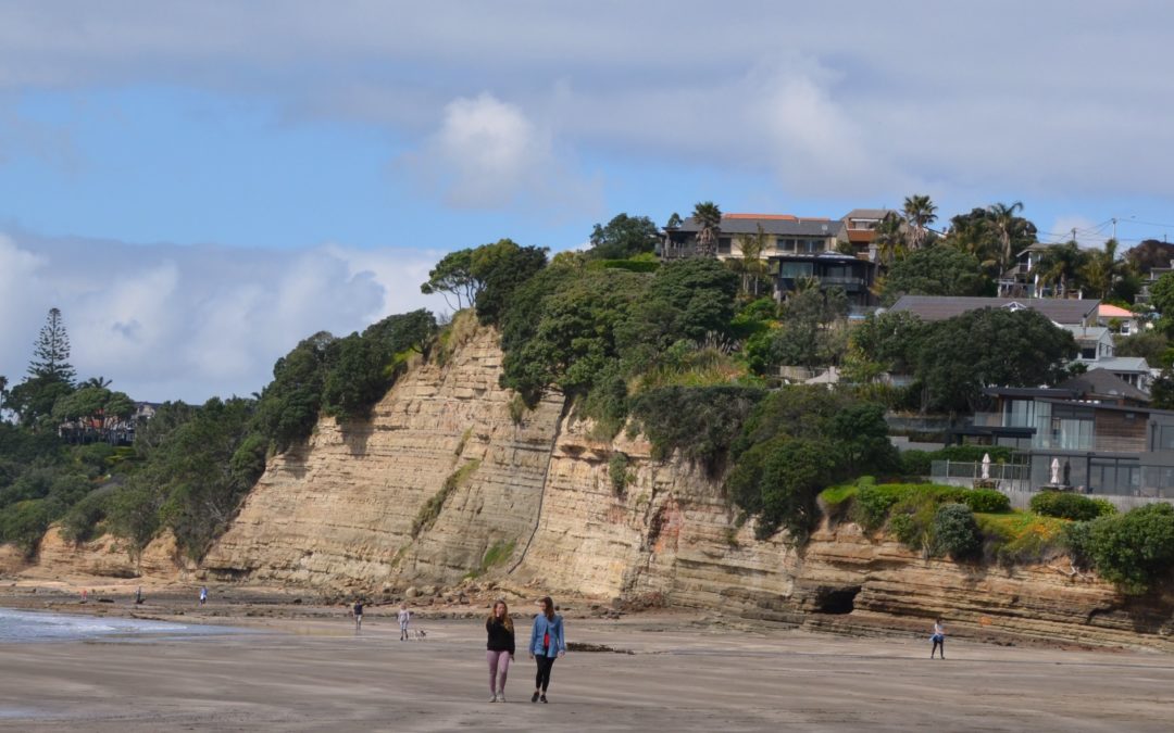
Coastal erosion is the loss of land due to coastal processes such as waves and tidal currents wearing away land, suddenly or over time. This can result in the slow erosion of shorelines, and the instability of cliffs as the base erodes.
Erosion rates along Auckland’s coast are changing over time as they are influenced by the effects of climate change, such as sea level rise, changes in weather patterns and the increasing intensity of rainfall.
What is meant by climate change?
Climate change refers to the changes to the present-day climate associated with the effects of global warming. Climate change is projected to have a significant impact on the land near the coast. This impact will come about especially through sea-level rise and intensification of storm events. National and regional analysis of how climate change will affect sea level has been carried out by the National Institute of Water and Atmospheric Research (NIWA), and it is this information that has been used to inform the coastal erosion study.
What sea level rise can we expect in Auckland?
Historic sea level rise in New Zealand has averaged between 1.6 and 1.8 mm/year, with Auckland exhibiting a slightly lower rate of 1.5 to 1.7 mm/year. Climate change is predicted to accelerate this rate of sea level rise in the future, and because of uncertainties about the future rate of climate change the exact sea level rise our city could experience is uncertain. To better understand what level of sea level rise might occur several scenarios are considered.
The sea level rise scenarios selected for use in this study are based on the most up-to-date available technical guidance from the Ministry for the Environment on projected sea level rise. This guidance is based on the scenarios presented by the Intergovernmental Panel on Climate Change (‘IPCC’).
The scenarios used by the IPCC are commonly referred to as ‘Representative Concentration Pathways’ (RCP’s). The primary purpose of the RCP’s is to provide projections of greenhouse gas concentrations, which correspond to changing energy levels within the atmosphere. Each RCP has been correlated with different rates of increasing sea level rise by NIWA.
Based upon recommendations from the Ministry for the Environment (2017), the coastal erosion hazard map for Auckland is generated based on 1.18 m of sea level rise by 2130, following the RCP8.5 median scenario.
The report models the RCP8.5 high scenario (1.52 m sea level rise over the next 100 years), and the RCP8.5 median scenario for two shorter timeframes (30 years and 50 years) to inform shorter term planning. The predicted sea level rises for these are 0.28 m and 0.55 m respectively.
What will future sea level rise mean for coastal erosion?
It is expected that sea level rise will increase the current rate of coastal erosion, and make erosion events more frequent. It is also likely to increase the frequency and intensity of damaging storm/weather events which will accelerate erosion effects.
Why have coastal erosion maps been produced?
The New Zealand Coastal Policy Statement directs councils to identify areas that may potentially be affected by coastal hazards over a timeframe of at least 100 years. Mapping is the most accepted method to identify hazard-prone areas and help provide the greatest level of certainty to the public.
Auckland Council also has requirements under the Resource Management Act (which requires that particular regard must also be given to the effects of climate change), the Building Act, the Local Government Act and the Civil Defence Emergency Management Act to have a good understanding of the areas potentially at risk from natural hazards to support appropriate land-use planning and development decisions.
What is the council doing to manage coastal hazards?
The information in TR2020/021 allows Auckland Council (AC) to better plan for responsible subdivision and development along the coast taking into account how erosion may influence the coast out to 2130, including the effects of sea level rise. These new data will be used, where required, to update AC’s regulatory provisions to manage future development (including intensification) within risk zones.
Auckland Council already has a strategy for managing coastal hazards across the region known as the Coastal Management Framework. This framework directed production of a series of Coastal Management Plans (CMP’s), each focused on a specific part of Auckland’s coastline, which outline how the council will consider options of defending, adapting, and/or retreating from these areas long term.
In partnership with the local communities and Mana Whenua, AC will use coastal hazard data, climate change forecasts, and community data to prepare these Coastal Management Plans. These plans will identify key areas of value and document AC’s intended approach to managing the coastline over the next century. Approximately 15 Coastal Management Plans will be developed across the region, starting with a pilot in Whangaparaoa in 2021. A series of public workshops will be held to explain how these plans will be developed, and how the communities can contribute and have their voices heard.
Auckland Council (AC) manages many assets in the coastal areas on behalf of the residents of Auckland. These range from parks to buried infrastructure such as pipes. AC will be using the information from this study in conjunction with the CMP’s to update their asset management plans. These plans will help AC to responsibly manage ratepayers’ assets while maintaining the quality of service that Aucklanders expect.
What existing or historical information already exists?
Auckland Council and its advisory partners have been working to understand and manage coastal erosion hazards across the region since early 2000 when the Auckland Regional Council instituted a programme to monitor the coastline of thirteen beaches across the region. In 2006, Auckland Regional Council commissioned a study to better understand the coastal erosion hazard and how to better manage its associated risks. The findings of the 2006 study informed the current Unitary Plan provisions.
How is the new report different?
The new assessment (2020) builds on the earlier findings and provides a comprehensive understanding of the extent to which our coastal environment is changing, taking into account sea level rise projections.
The assessment documented in Technical Report 2020/021 identifies areas of Auckland’s coastline that are predicted to be susceptible to coastal erosion and instability. The findings provide a high-level understanding of potential erosion rates across the region and are presented in tabular and mapped form.
What are the regional coastal erosion heat maps?
The coastal erosion heat maps show the predicted extent of coastal areas that may be susceptible to instability and erosion out to the year 2130. They provide an illustration of a range of land instability and erosion distances for both cliff and low-lying shorelines along Auckland’s coastline.
These maps display the coastline of Auckland, colour coded to show areas predicted to be susceptible to coastal instability and erosion. There are separate maps for each of the modelled scenarios. Cliffs and low-lying areas are presented separately as they use a different model to generate the maps.
These maps help differentiate between areas with different future rates of erosion.
Will these maps be shown on Auckland Council’s online maps (GIS)?
The results of the study will also be presented in an online map format that will provide a mechanism to zoom in to the results. These maps are currently being prepared and will be available on Auckland Council’s GIS system ‘GeoMaps’ by mid-2021.
Will this information be included on Land Information Memorandums (LIM’s)?
Auckland Council has a statutory obligation to issue a LIM upon application in relation to any property within the Auckland region. LIMs must identify special features or characteristics of the land concerned that are known to us, including potential erosion, subsidence, slippage, or inundation.
Accordingly, the hazard maps will be included or referred to on LIMS where applicable, once the data has been finalised and approved,
Who will have access to this information
The technical report will be publicly available on the Council website, and to any person upon request.
How will this information affect the use or development of my property?
This is a regional scale study. The reports and modelling results apply to broad areas and may be superseded by site-specific assessments by qualified professionals who undertake more localised assessments than presented in this study.
Any concerns about the impact of this information on your use or development of your property will need to be addressed to the appropriate professionals.
Could this information affect my property value?
AC is not able to advise on what, if any, effect this information will have on your current or future property value. Advice on this should be sought from the appropriate professionals.
Could this information affect my insurance?
AC is not able to advise what effect, if any, this information may have on individual insurance policies. Advice on this should be sought from your insurance provider.
How could this information be used in subdivision and land use consents under the RMA?
For any application for a new subdivision, council is required to assess the risk of the proposal under section 106(1A)(b) and (c) of the Resource Management Act. This includes the likelihood of a natural hazard event occurring, as well as the potential consequences.
The Auckland Unitary Plan already has rules relating to activities in coastal erosion hazard areas to ensure that the risks are appropriately managed. The new information presented in this report will also be able to be considered in planning decisions.
A plan change is being developed to incorporate this new data into the Auckland Unitary Plan. The plan change will ensure the new information on the extent of predicted erosion is taken into account in a resource consent process. Because the new study was undertaken at a regional-scale, it will still be possible to do a site-specific assessment to determine the erosion risk for a particular site as part of the resource consent process.
To help determine the required process and scenarios to be used in any application please contact the council’s Regulatory Services Directorate – Resource Consents or Building Consents departments.
How could this information be used in building consents under the Building Act?
The Building Act states that building consent authorities must refuse to grant a building consent for construction of a building, or major alterations to a building, if the land on which the building work is to be carried out is subject or is likely to be subject to one or more natural hazards, and appropriate hazard minimisation provisions are not proposed. This includes coastal erosion.
Because the current study was undertaken at a regional scale, it cannot be used to confirm if a site is ‘likely to be subject to one or more natural hazards’ at the level of detail required for a building consent. The results will be used to identify if more detailed assessments are needed to support the consent application. These will be done by qualified professionals working for the applicant.
To help determine the required process and scenarios to be used in any application please contact the council’s Regulatory Services Directorate – Resource Consents or Building Consents departments.
Where can I find more information?
Links to further information about coastal hazards are available on the Auckland Council coastal webpage.
If you want to know if coastal instability and erosion will affect your existing coastal property, or perhaps property you’re intending to purchase – then allow us to assist you. Contact Geohazard Assessment Services to arrange an expert and affordable site-specific geohazard inspection and assessment – ‘know the ground beneath your feet’
Recent Comments